
Monday, September 30, 2024
Thursday, September 19, 2024
Burying splendid farmland... and the past
So there I was
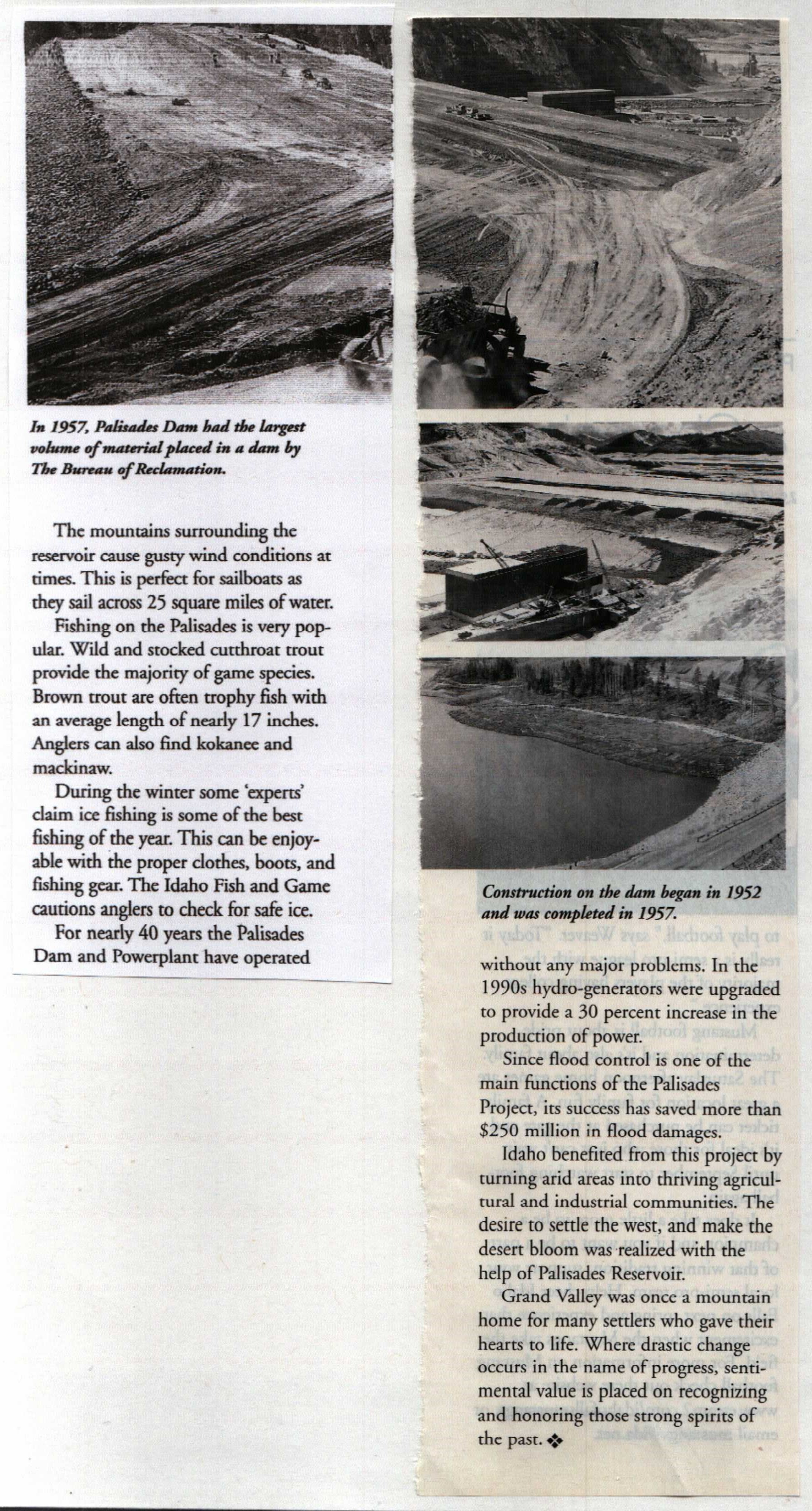
I just finished scanning every page of Larry Fleming's 'Dam Kids' binder, full of photographs, newspaper clippings, drawings, surveys, maps and life stories. Here are pages 2-5. This is an article in Idaho Falls Magazine. I don't know the date.


Monday, September 16, 2024


Sunday, September 15, 2024
The old road and the new road......,...
Well, a decision was made; the road was rerouted and the schools consolidated. They were going to flood the grand valley, build a dam for all Idahoans' prosperity. Hardworked homesteads left for simple pennies per acre. What did they have invested in them? Blood. Sweat. Tears.

In the lower picture you can see both roads. Photo credit is hazy: Larry Fleming? Dam Kids? Let me know and I'll fix it.......


Friday, September 13, 2024
Reservoir Displaces Longtime Farm Families
This article is from the Post Register. This image is from a binder of memorabilia about the Dam Kids collected by Larry Fleming over the years. All of the contents of the binder have been scanned and sent to The Atlas of Drowned Towns for them to add to their database. We will regularly be posting images and articles from the binder to this blog and we will share those posts on our social media. The best way to stay up to date on the progress of our research into Grand Valley is to follow our Facebook page, Swan Valley Old Timers.

Thursday, September 12, 2024
1935 Surveyor Map of Grand Valley and a later undated Surveyor Map of Alpine area
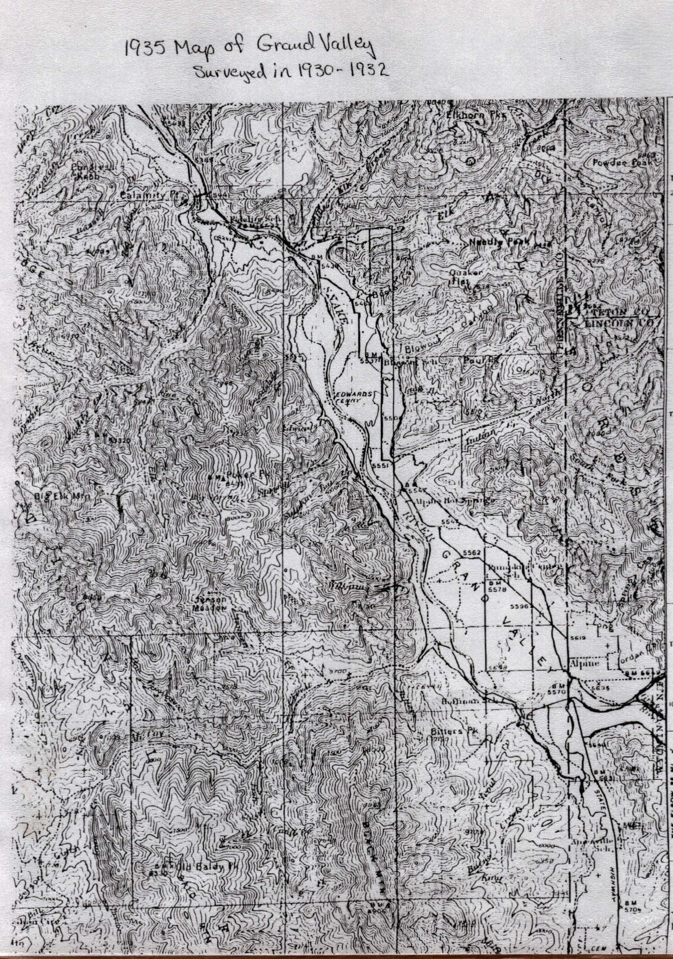
The above map shows Alpine on the north side of the river. The Alpine townsite was moved across the river to accomodate the rising waters of Palisades Reservoir. Unlike the lower map, the upper map marks the Hoffman School, Pumpkin Center, Blowout, and Fidelity, as well as the Edwards Ferry.
the lower map is undated, but possibly represents a time before the reclamation of the land began but after the consolidation of the schools; 1949 or 1950.

Tuesday, September 10, 2024
Handdrawn Map of Grand Valley by JoAnn Cromwell and Josie Byrd
Here's another hand-drawn map of Grand Valley before the Palisades Reservoir flooded the valley. Let us know about any errors or discrepancies, as we are using this information to make sure we tell an accurate story of the families because of the Palisades Dam Project.


Monday, September 9, 2024


Saturday, September 7, 2024
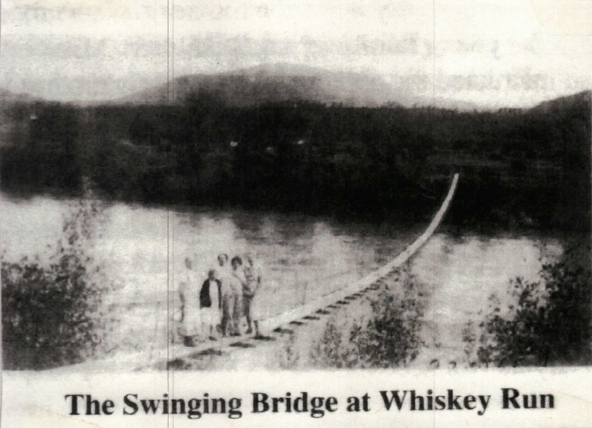
The Swinging Bridge in Grand Valley
We all know the stories of Dora Daniels beloved Swinging Bridge in Irwin, but did you know there was another swinging bridge that helped the families that farmed on the southeast side of the river near Bear Creek. The Fidelity School (also called Whiskey Run was on the other side of the river from the homesteads so a bridge was built so they could attend school. The road was also on that side of the river, so the bridge made life in Bear Creek easier. Families could attend church on Sundays or get out for supplies in the winter. There were dances at the school on weekends and they could attend after the bridge was built, creating more opportunities for the Bear Creek families and staving off the loneliness of rural life. (Photos from 'The Dam Kids' scrapbook, Larry Fleming)

Wednesday, September 4, 2024
William Heber and Arlitta Hatfield Adams
Many of the longtime residents of Swan Valley are descendants of William Heber and Arlitta Hatfield Adams. Here's a list of their children. You will see their daughters married into some familiar family names, like Jacobson and Beasley. Below, Arlitta and William life histories. (from the Hatfield Family History, Larry Lovell)


Subscribe to:
Comments (Atom)