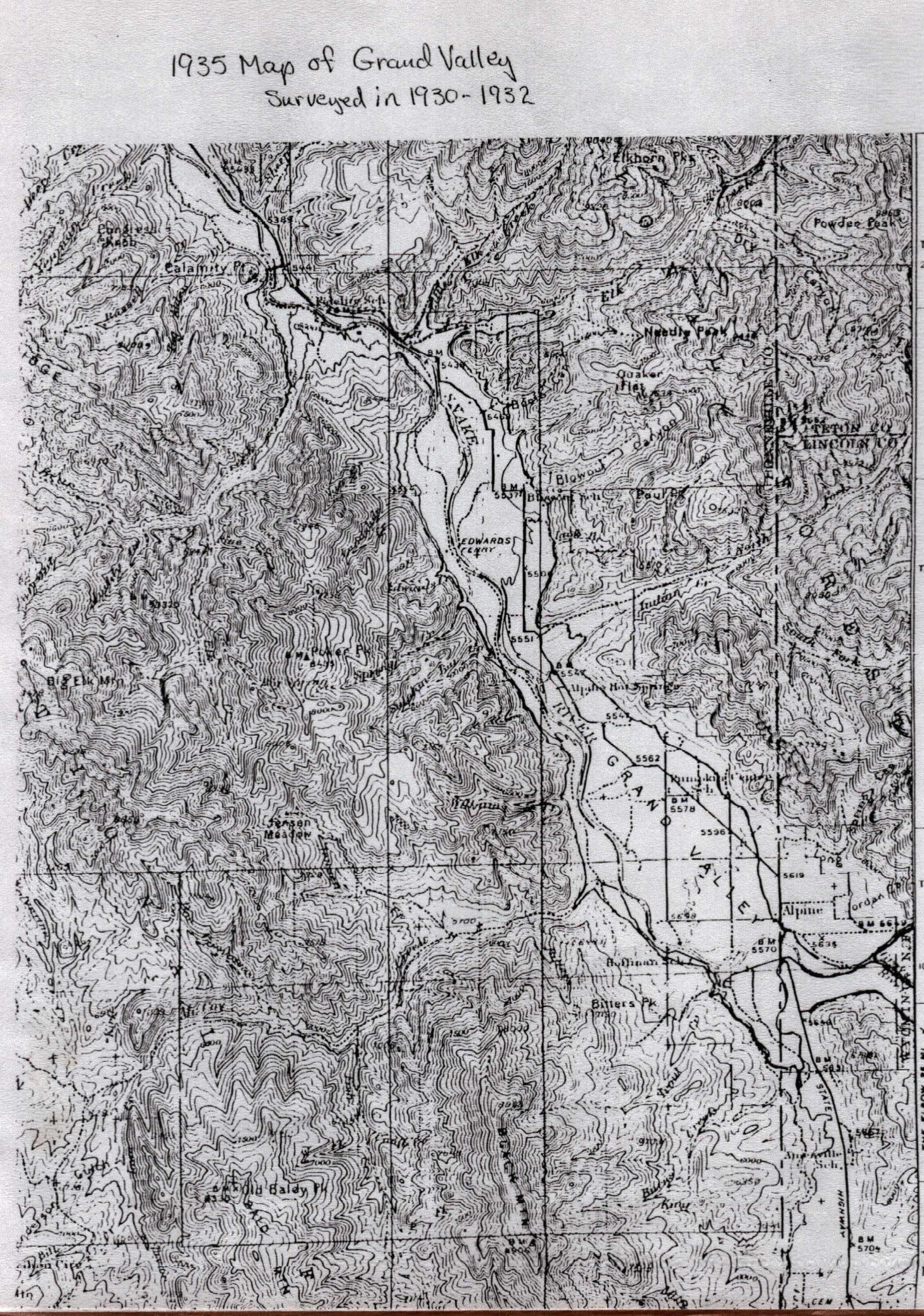
The above map shows Alpine on the north side of the river. The Alpine townsite was moved across the river to accomodate the rising waters of Palisades Reservoir. Unlike the lower map, the upper map marks the Hoffman School, Pumpkin Center, Blowout, and Fidelity, as well as the Edwards Ferry.
the lower map is undated, but possibly represents a time before the reclamation of the land began but after the consolidation of the schools; 1949 or 1950.

No comments:
Post a Comment